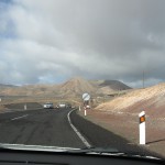
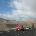
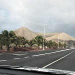
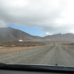
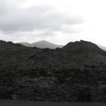
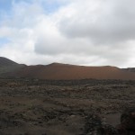
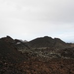
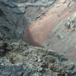
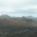
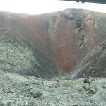
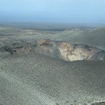
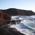
It’s the beginning of December and the temperature in Slovakia has dropped below freezing. How about cooling off in the ocean on an eternal spring island? We decided to visit one of the Canary Islands – Lanzarote. We combined two Ryanair flights BA – Brussels, Brussels – Lanzarote and hoped that nothing would happen during the layover. The trip was successful and the lunar landscape of Lanzarote left a deep impression on us. That feeling is hard to describe, you simply have to experience it. Imagine a volcano crater where you are completely alone, the warmth of a volcano cooking chickens, beautiful beaches with yellow sand, a green lake, or a magical lagoon. Many scenes from the movie Planet of the Apes were even filmed here. And especially when people in winter coats walk in Slovakia and we cheerfully swim in the waves of the Atlantic 🙂 We said to ourselves that we must come back to the Canaries.
Contents
Day 1 – Layover in Brussels
Day 2 – Lanzarote – Puerto del Carmen
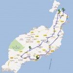
Day 3 – SOUTH of the island (114km circuit)
Day 4 – CENTRAL part of the island (94km circuit)
Day 5 – NORTH of the island (136km circuit)
Day 6 – Rest day
Day 7 – Morning departure
Day 1 – Transfer in Brussels
We landed in the town of Charleroi around noon. Our accommodation was a bit far from the airport, but our attempt to walk there failed, so we had to call a taxi, which had agreed on a somewhat reasonable price with the hotel. Hotel Etap was a good solution for an overnight stay with a TV and wifi, so time flew by quickly. In the morning, we had a very early wake-up call and we were freezing even just getting into the van to the airport. It must have been below zero and lightly snowing, so it was high time to move to warmer surroundings.
Day 2 – Lanzarote – Puerto del Carmen
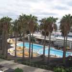
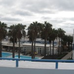
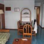
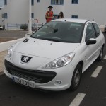
We landed in Lanzarote around 10:00 local time, as there was a time difference of -1 hour. At first glance, we couldn’t tell if it was warm or cold. Right at the airport, we picked up a car from Plus Car company. It was a white Peugeot 206+ with only 7000km driven, looking like new. We were staying just a short distance from the airport in the town of Puerto del Carmen in the terraced houses of the Aparthotel Costamar with a large pool in the middle. We got a whole apartment with a kitchen, living room, laundry room, and a terrace overlooking the pool. We settled in and went to buy food and drinks at the Spar supermarket.
TIP: Spar is one of the cheaper supermarkets and you can get everything you need there.
We bought ingredients for a salad, baguettes, salami, cheese, ketchup, juices, cola, various wines, and we also wanted to try one of their typical Mojo sauces. However, we personally do not recommend the Mojo sauce because we didn’t like the taste of it. We made some sandwiches, accompanied them with wine, and headed to our local beach Playa de Los Pocillos. It was a typical long urban beach and there was nobody around 🙂 We jumped into the water, swam a little, and when we got out, the wind felt like a blow dryer – we were dry within minutes 🙂 Our apartment was only 5 minutes away, so we quickly went back home to avoid getting too cold. In the evening, we enjoyed a relaxing time on the terrace. Stretching our legs on the railing, music playing, and wine while watching the sunset. Later in the evening, we went to explore the town. We discovered a great Chinese restaurant where they even brought us liqueur as a gesture of kindness. We fell asleep pleasantly tired from a busy day.
Day 3 – SOUTH of the island (114km circuit)
We had breakfast in the large hotel dining room. We were surprised by how much we lowered the average age there. Indeed, German retirees are really enjoying themselves when they choose to spend a month on the Canary Islands. The food in buffet style was more than enough, and we indulged in it. Then a little rest in the room, packing our things, and we set off on our first circuit to the south of the island. Puerto del Carmen was passed via the bypass to avoid delays. Next was the village of Macher, and then it was just wilderness, hills, and a moon-like landscape with no sign of greenery. By the way, it’s worth noting that all villages were in a uniform style, with white square houses. We continued through the hills and stopped at a viewpoint according to the map. We were almost blown away there, so we quickly got back into the car.
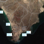
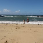
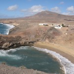
We are heading south of the island, and after turning off the main road, only an unpaved gravel road follows. The shock absorbers were really put to the test 🙂 Most of the cars that passed us were rentals. Then comes a ramp and entrance to the Papagayo reserve, where we had to pay an entrance fee for the car. Numerous signposts show us the way to several beaches. The first beach we visited was the golden Playa Mujeres. Almost no one around, beautiful golden sand, and a dark rocky hill that we climbed. We took a dip in the water and continued to the arguably most beautiful beach on paper, Playa de Papagayo. A gorgeous cove surrounded by hills, each offering a different view. Not the best for swimming though, as there are many little stones that the waves splash against your feet, more of a place for photos.
We gather some sand in a bag, take panoramic photos, admire the peak of Hacha Grande, and head on to Puerto Muelas. You can camp here during the season; the large area has electrical blocks, showers, and toilets. We continued directly to the beach, which was a bit boring 🙂 We had sand everywhere by now, in our eyes, ears, mouths, noses, it was very windy. We ate the last of our homemade salad that we had prepared and continued our loop through the town of Playa Blanca, where we took a short break at the beach. Our little car finally breathed after a good stretch of asphalt road.
Heading north, we see the salt flats of Salinas Del Rio, the cliffs of Los Hervideros, and ubiquitous lava rocks and volcanic terrain. The last stop is the green lagoon Laguna Verde, supposedly colored by algae, which we took a short walk along the rocky cliffs to reach. For the sake of photos, we also drove from the other side of El Golfo bay and then it was truly time to head home.
We also tried to see the vine valleys of La Geria, but halfway there, we had to turn back if we didn’t want to break the car. The road was unpaved, rocky, bumpy, and getting worse as we went. We promised ourselves never to drive on such a road again, and we kept that promise. The evening was filled with wine, music, and cigars. Again, we went to have a bite to eat in town.
Day 4 – CENTER of the island (circuit 94km)
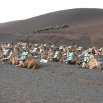
The day begins, as usual, with a hearty breakfast and packing the essentials into the car. The main point of today’s program is the Timanfaya National Park. So we head straight there, passing Macher, Uga, Yaiza, and on the way, we couldn’t resist riding the camels. The price was relatively fair at 6€/person, as one camel had seats for two people. The camels walked in a line of about 5 pieces, and our guide was a great comedian, subtly nudging a friend in the ribs pretending it was a camel, or disconnecting one camel and directing it straight towards a cliff 🙂 The ride lasted about half an hour and was a pleasant addition to the program.
We continue further into the national park, paid the entrance fee, and parked the car in the parking lot. For safety reasons, the tour of the national park is only possible by bus; you cannot move freely there. Indeed, at times we even admired the driver’s skills because the road was really narrow, the terrain was rugged, and without guardrails. A landscape dotted with craters and lava fields, believe me, we wouldn’t want to be there when everything was erupting. Imagine adding mystical music with expert commentary to that, and the perfect experience is guaranteed. The park covers an area of 200 km2, and the accessible section is not for nothing called Montanas del Fuego, or the Fire Mountains. The park’s territory is marked by images of stylized devils, created by the omnipresent César Manrique on the island. He is also the creator of the popular and very original El Diablo restaurant, where you can enjoy dishes grilled over the heat emanating from the Earth’s depths. The last volcano erupted here in 1824, yet it is still possible to measure 600°C just 10 meters below the surface and 12°C on the surface. We were convinced of this by the “shaman” who poured a bucket of water into a pipe, and within a few seconds, the water spouted back. We looked inside the restaurant, stopped by a souvenir shop, and could continue because the rain was hanging by a thread.
We continue northward and make a stop at the Visitors Centre. It was supposed to be an introduction to the park visit, but nothing happened when we visited it after the tour. There was information about the history and some geology of volcanoes. We had them recommend a very beautiful crater that is easily accessible on foot.Volcan del Cuervo, which we planned to visit the next day.
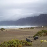
Our next stop was the El Rio bay, a circular little peninsula where we parked the car and climbed a bit on the rocks to take a look. It seemed like a storm was approaching, but we didn’t expect it to come so quickly. The few hundred meters we ran back to the car left us completely drenched 🙂 At the end of the day, we visited the surfing beach Famara, where we wouldn’t swim anyway. Right next to the beach, the highest mountain range of the island stood out. We took some photos and headed back home in our little car.
It was Saturday, and we decided to look for a nightclub. Everywhere they tempted us with free shots, so we gave it a try. Tomáš arranged some tequila shots, we downed them, and discreetly disappeared because no one else was there 🙂 We spent a while in front of the Big Apple club, but everything indicated that it only gets lively during the season. The music was playing loudly, and they even had quality rap music, but we could count the people on two hands. We took a short walk on Playa Grande beach and then headed back home.
Day 5 – NORTH of the island (circle 136km)
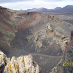
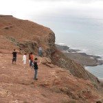
Early in the morning, we set off for the last circle around the island, completing our exploration. The first point of interest on the route was the crater of the volcano Volcan del Cuervo. We parked the car on the road to the crater, took some “moon-like” photos, and went for a hike.can begin. After about 30 minutes of hiking, we reached our destination. First, we climbed up the crater wall and were rewarded with a magnificent view from the top into the former volcano crater; it was an experience. Then, we slid down the volcanic surface into the crater and even stepped inside as there was a side opening. Just imagine, the whole crater to ourselves and absolute silence. We spread out our towels and took a quick nap. Inside the crater, there were many different types of rocks, and I believe if this was back home, there wouldn’t be a trace of them left.
It’s after lunch, and we are heading back to the car. On the way north, we passed by the village of Nazaret, so we looked for a sign and took a photo as proof. Next was Teguise, which was once the capital and the serpentine road through the island’s highest mountain range. We only admired the highest peak, Peñas del Chache (670m), from a distance as there is a military base with a radar there. So, we improvised a bit and instead explored a beautifully maintained mountain ridge nearby reminiscent of Machu Picchu. We didn’t get far by car, so we parked it and went for a short hike. People had their land guarded by a dog; fortunately, it was tied up, but we still felt uneasy when we heard barking without seeing any dog.
On our way back, a few motorcyclists zoomed past us. We continue on to the town of Haria. Along the way, there was a turnoff to a tropical park, so out of curiosity, we stopped by, but it was a bit pricey, and we could hear the bird sounds even from the parking lot. Next up is a viewpoint.Mirador del Rio, where we enjoyed an idyllic view of the Isla Graciosa island.
TIP: You don’t have to pay entrance fee, just skip the wall, even though there is a prohibition, but everyone did it that way 🙂
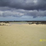
We took panoramic pictures and continued to the northernmost town of Orzola. It is also a port and the starting point for the Graciosa island. A short distance from there, we found, in our opinion, the most beautiful beach on the island that we visited. Playa Caletón Blanco is a beautiful lagoon separated from the ocean by rocks with crystal clear water. Ideal for families with children, as the water is knee-deep for a long stretch. We couldn’t resist either and jumped in.

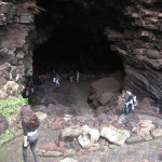
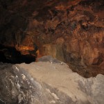
The demanding day continued with a visit to the underwater lava tunnel Cueva los verdes, one of the longest volcanic tunnels in the world. It is a 6km long tunnel with sophisticated lighting, of which 2km are publicly accessible. There are even concerts held here with a capacity of up to 500 people. An interesting moment was when the guide asked us not to lean over as there was a deep abyss. She then threw a stone and showed us that it was just a pond and a reflection in the water 🙂 A short distance from the tunnel is the cave Jameos del Agua, but we thought it would be something similar, and we were already short on time. On the way home, we also stopped at a cactus garden and took photos of at least a giant cactus at the entrance gate.

Day 6 – Rest Day
The whole day it was more or less raining, so we decided to have a rest day. Sitting on the terrace, listening to music, surfing the web, watching TV shows and The Simpsons on our phones. In the afternoon, we just took our towels, jumped into the ocean for one last time, and quickly returned to our room so we wouldn’t catch a cold. We also tried the hotel pool, where the water was downright icy 🙂
Day 7 – Early Departure
For breakfast, we packed our bags so we could make it to the airport on time. We took some photos of our rental car, just in case, and left the keys under the seat. The final mileage on the odometer was 783.4 km, while we started at 432 km 🙂 The flight was scheduled for 10:30, but we ended up being delayed by about 45 minutes. The important thing is that we took off. In less than 4 hours, we were greeted by a snowy Charleroi and temperatures as cold as in Siberia. The end of the day flew by quickly, and we went to bed early because of an early wake-up call at 4 a.m. to catch our flight back to Slovakia at 7 a.m. Everything went smoothly without any further complications, and a beautiful trip was behind us.
